Dirección Pje. Raúl Jiménez Chavez 16B-9, Puerto Maldonado
Horario de atención Lunes a Sábado: 8AM - 6PM
PROVEN TECHNOLOGY IN MINING EXPLORATION
Satellite Mining Prospection for Right Decisions Before Investing in the Field.
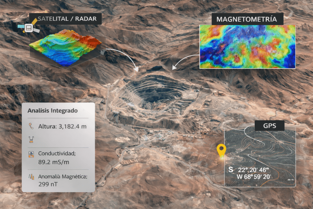
We identify areas with high mineral probability through advanced technical analysis, integrating satellite imagery, radar, geophysics, and mining cartography to reduce risks, optimize time, and maximize ROI from the start.
We solve the main problem of mineral exploration: investing time and capital without sufficient technical information.
At Mapa de Tesoros, we conduct comprehensive terrain analysis to identify genuine mineralization opportunities before commencing fieldwork. Our approach allows us to reduce losses, optimize resources, accelerate decision-making, and provide technical support and professional standing to those leading mining projects.
We work with reliable data, methodology, and experience so that every decision is supported and does not depend on chance.
Where does it make sense to explore?
Satellite Analysis of Mining Potential for Profitable Decisions Before the Field
We make decisions using satellite and geospatial analysis, reducing random exploration before going into the field
Professional technical analysis
Solid technical information, clearly explained for miners, entrepreneurs, and investors
Responsibility and sustainability
Studies developed under technical, legal and environmental criteria, within the regulatory framework
Perform a
Satellite Study of Location and Mining Potential
Our study analyzes your area by integrating geology, geomorphology, structures, and satellite data to identify zones and points with greater mineral consistency before any on-site intervention.
It’s a technical tool to reduce uncertainty and make informed decisions based on professional judgment.
Applicable to gold, copper, silver, and other minerals.
Veins, alluvial and alluvial deposits (according to regulations).
Their maps allowed us to focus our exploration on areas with real potential. The result: savings in time and investment, and better discoveries in the field.
Juan P.
With its technology, satellite prospecting has allowed us to discover gold-bearing areas that we previously overlooked. Today, these areas are among our most profitable operations.